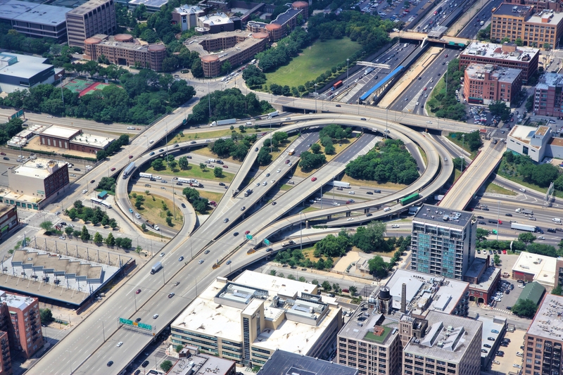
By enabling the faster transport of people and goods, the Interstate system transformed the U.S. economy. Some of its unique features include limited-access ramps and over- or underpasses for intersecting highways. Credit: Tupungato|Dreamstime.com.
Roads profoundly shape local economies. Consider the Disney movie Cars with its fictional small town of Radiator Springs on U.S. Highway 66. “Cars didn’t drive on it to make great time,” says movie character Sally Carrera. “They drove on it to have a great time.”
That was before an Interstate freeway was built just south of town. Businesses felt the impact: Travelers who used to stop in Radiator Spring to shop, eat or fill up their tank were now zooming right past it.
This economic decline drove the movie narrative but did not tell full story of the Interstate System, launched by the 1956 Federal-Aid Highway Act. To measure its impact on a national scale, AAE assistant professor Dustin Frye developed a new analysis method.
“I have long been interested in the history of the Interstate network and its contribution to the universe of U.S. economies, from urban and suburban to rural communities,” says Frye. “My specific goal was to estimate how much of a county’s economic growth in six decades was due to receiving a freeway segment.”
The short answer: From 1956 to 2016, counties in the lower 48 states that received Interstates experienced a faster economic growth than those that did not. A typical Interstate county had 115 to 230 more firms and 2,400 to 4,200 additional jobs.
To develop the method behind these numbers, Frye considered the history that helped President Eisenhower become the “Father of the Interstate System” in 1956. It started with the grueling experience of a 1919 military convoy from Washington D.C. to San Francisco, when Eisenhower was a 29-year-old Army officer. The abysmal patchwork of dirt, gravel and paved roads prompted the Army to create the first Interstate map under the leadership of General John Pershing in 1922.
But the time was not yet ripe for a nationwide overhaul of that patchwork system. Funding priorities changed with the 1929 Depression followed by the New Deal and World War II eras, although lawmakers, military officials and engineers continued to refine the Pershing Map. Impressed with Germany’s Autobahn during World War II, Eisenhower championed a similar system in his 1952 presidential campaign. His selling points were economic growth, traffic safety and Cold War national defense.
The tipping point that helped Eisenhower launch the nation’s largest public infrastructure project in 1956 was a new funding model passed by Congress: While federal and state governments had each covered 50% of earlier highway construction costs, the federal share for Interstates increased to 90%, largely financed by taxes on gasoline, tires and vehicles.
That funding model had practical consequences: Congress decided on the location and mileage of Interstate segments, and states determined the timing of construction. Thus, Frye’s analysis method had to account for the fact that neither locations nor construction years were randomly chosen—the ideal setting for testing if Interstates caused an outcome of interest.
“Politicians used Interstates as a place-based policy by assigning more mileage to weaker economies, hoping the roads would deliver a boost,” says Frye. “But stronger economies and towns with more lobbying power were more likely to receive their freeway segments early.”
When construction decisions are influenced by the outcome of interest, causal effects can no longer be assessed. To tackle this challenge, Frye turned to the 1922 Pershing Map (a copy of which hangs on his office wall). Designed to quickly move military goods and civilians across the country and defend its borders, this early blueprint resembles the eventually realized Interstate system—but is unrelated to economic conditions and lobbying activities more than 30 years later.
Another advantage: The Pershing Map is, for the most part, a network of strategically chosen straight-line corridors between cities. This structure allowed Frye to derive a theoretically optimal construction sequence, based on the importance of each segment for moving around the country. An optimal deployment of construction crews would start with the most heavily traveled sections and end with the least heavily traveled ones.
The optimal construction process that shared essential features with its real-life equivalent became the centerpiece of Frye’s analytic strategy: It helped remove the bias created by the non-random assignment of freeway segments to counties. The results showed that Interstates caused about one-third of the accelerated economic growth in the counties that received them, especially during the initial expansion era (1956-1975).
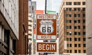
The study also added nuance to reports of economic decline in rural counties without Interstates, as in the movie Cars. “In the decades after the initial expansion era, many counties that lacked Interstates but shared labor markets with nearby metropolitan areas also experienced economic growth,” says Frye. “This highlights the importance of other infrastructure—roads or public transit—to connect housing developments in urban peripheries with job opportunities in city centers.”
Today’s Interstate system of nearly 50,000 freeway miles has been both celebrated and criticized. Beyond its physical footprint of paved roads and bridges, this massive infrastructure project has transformed virtually all economic sectors, including U.S. agriculture.
Trucking, for example, quickly displaced rail for transporting many agricultural goods. This gave farmers access to larger domestic and international markets. But Interstates also created more competitive local labor markets: They made it easier for rural residents who had traditionally focused on agricultural work to commute to service sector and manufacturing jobs instead.
“This study assessed how Interstates reshaped the economy over decades,” says Frye. “But that aggregate growth hides very different stories across places and industries. My upcoming work examines those stories more closely, starting with how the Interstate System transformed agriculture and manufacturing.”